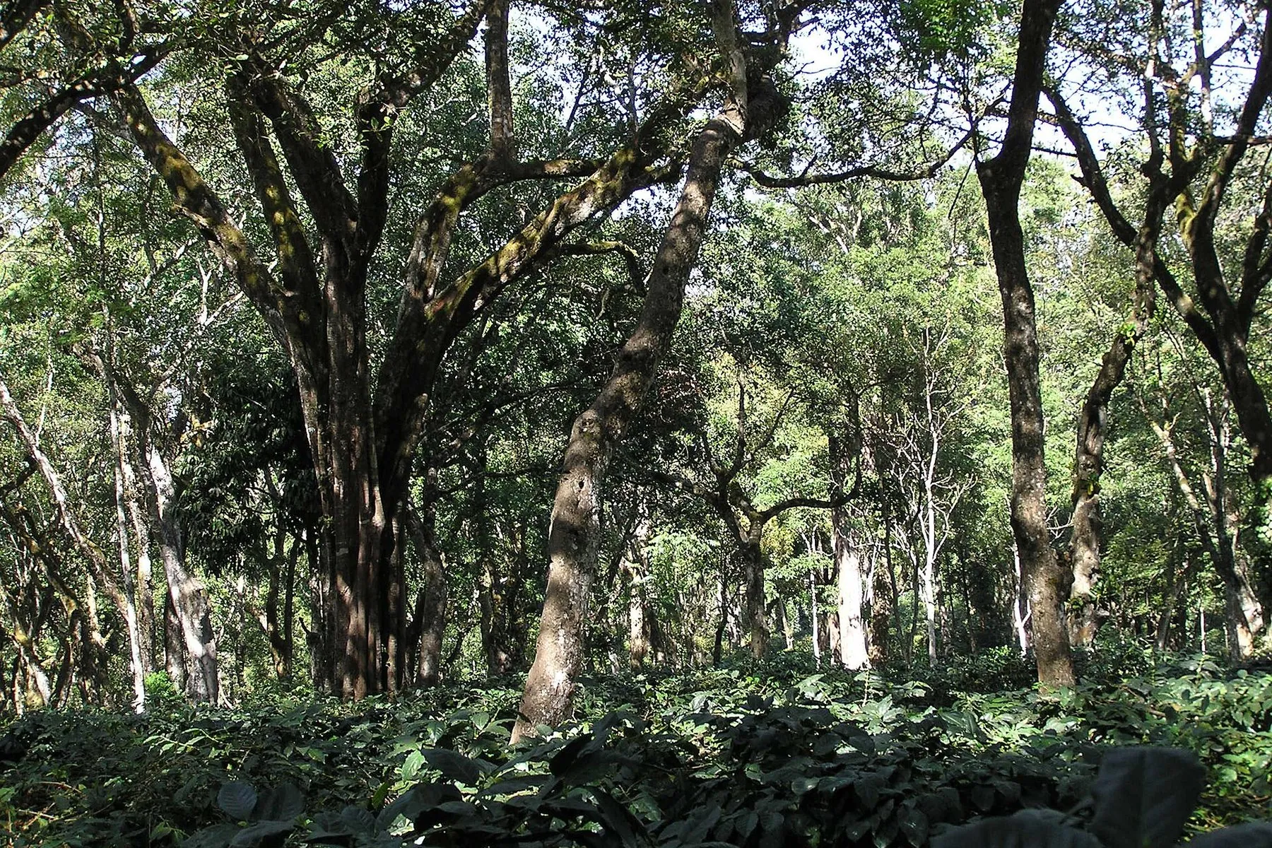
Kudremukh, Chikkamagaluru, solarisgirl, CC BY-SA 2.0, via Wikimedia Commons
Mullayanagiri, Likhith N.P, CC BY-SA 3.0, via Wikimedia Commons
Mullayanagiri ridge, రవిచంద్ర, CC BY-SA 4.0, via Wikimedia Commons
Coffee origin illustration, Companion illustration, Original artwork for this site
Seven seeds title plate (companion illustration), Companion illustration, Original artwork for this site
Ethiopian highlands (companion illustration), Companion illustration, Original artwork for this site
Mocha harbour (companion illustration), Companion illustration, Original artwork for this site
Mocha voyage lore (companion illustration), Companion illustration, Original artwork for this site
Early Ghats coffee estate (companion illustration), Companion illustration, Original artwork for this site
Chandra Drona hermitage (companion illustration), Companion illustration, Original artwork for this site
Shade coffee and research bungalow (companion illustration), Companion illustration, Original artwork for this site
Coffee canopy path (companion illustration), Companion illustration, Original artwork for this site
Baba Budan (companion illustration), Companion illustration, Original artwork for this site
Akki rotti, Companion photograph, Original artwork for this site
Filter coffee, Companion photograph, Original artwork for this site
Pathrode, Companion photograph, Original artwork for this site
Kotte kadubu, Companion photograph, Original artwork for this site
Neer dosa, Companion photograph, Original artwork for this site
Jackfruit chips, Companion photograph, Original artwork for this site
Baba Budangiri, Gpkp, CC BY-SA 4.0, via Wikimedia Commons
Kudremukh, Dhruvaraj S, CC BY 2.0, via Wikimedia Commons
Kemmanagundi, Srinivasa83, CC BY-SA 3.0, via Wikimedia Commons
Mullayanagiri, Anvesh1103, CC BY-SA 4.0, via Wikimedia Commons
Kemmangundi sunset, RakeshRaju M, CC BY-SA 4.0, via Wikimedia Commons
Hebbe Falls, Ashwin Kumar, CC BY-SA 2.0, via Wikimedia Commons
Jhari Falls, Likhith N.P, CC BY-SA 3.0, via Wikimedia Commons
Hanuman Gundi Falls, Jesjose, CC BY-SA 4.0, via Wikimedia Commons
Sirimane Falls, Sanath11, CC BY-SA 4.0, via Wikimedia Commons
Near Kallathigiri Falls, Venkat Mangudi, CC0, via Wikimedia Commons
Hirekolale Lake, Rinyogi03, CC BY-SA 4.0, via Wikimedia Commons
Ayyanakere Lake, Vinay Kumar C Unicor, CC BY-SA 4.0, via Wikimedia Commons
Bhadra Wildlife Sanctuary, Hbsahoo1986, CC BY-SA 4.0, via Wikimedia Commons
Lakya Dam, b sarangi, CC BY 2.0, via Wikimedia Commons
Sringeri Sharadamba Temple, Ashok Prabhakaran, CC BY-SA 2.0, via Wikimedia Commons
Horanadu Annapoorneshwari Temple entrance, Hari K Patibanda, CC BY 2.0, via Wikimedia Commons
Amrutesvara Temple, Amruthapura, Dineshkannambadi, CC BY-SA 3.0, via Wikimedia Commons
Veeranarayana Temple, Belavadi, Doc.aneesh, CC BY-SA 3.0, via Wikimedia Commons
Vidyashankara Temple, Sringeri, Chiranjeevi Kuruba, CC BY-SA 4.0, via Wikimedia Commons
Kudremukh National Park, Navi guy, CC BY-SA 4.0, via Wikimedia Commons
Charmadi Ghat, Dinesh Valke, CC BY-SA 2.0, via Wikimedia Commons
Ettina Bhuja, Shashidhara halady, CC BY-SA 4.0, via Wikimedia Commons
Deviramma Temple, Mallenahalli, Basavarajmin21, CC BY-SA 4.0, via Wikimedia Commons
Deviramma Betta, Yakshitha, CC BY-SA 4.0, via Wikimedia Commons
Coffee estate, Chikkamagaluru, Ashwin Kumar, CC BY-SA 2.0, via Wikimedia Commons
Manikyadhara, Kgpramod2, CC BY-SA 4.0, via Wikimedia Commons
Z Point, Shivakant7, CC BY-SA 4.0, via Wikimedia Commons
Bhadra Dam, Lakkavalli, Kandukuru Nagarjun, CC BY 2.0, via Wikimedia Commons
Shade-grown coffee, Anand Osuri, CC BY-SA 4.0, via Wikimedia Commons
Traditional shade coffee, Anand Osuri, CC BY-SA 4.0, via Wikimedia Commons
Amedikallu from Shishila, IndianCourser, CC BY-SA 4.0, via Wikimedia Commons
Bandaje Falls, Mallanagoud017, CC BY-SA 4.0, via Wikimedia Commons
Gangadikal, Kudremukh, solarisgirl, CC BY-SA 2.0, via Wikimedia Commons
Jenukallu Gudda, Thushar p s, CC BY-SA 4.0, via Wikimedia Commons
Kurinjal Peak, Kudremukh National Park, 789rajes987, CC BY-SA 4.0, via Wikimedia Commons
Meruthi Hills, Basarikatte, AshwathAcharya, CC BY-SA 3.0, via Wikimedia Commons
Trekking trail on Netravati peak, iMahesh, CC BY-SA 4.0, via Wikimedia Commons
Sri Math, Hariharapura, Knguru, Public domain, via Wikimedia Commons
Tunga River in front of Hariharapura temple, siddushiv, CC BY-SA 3.0, via Wikimedia Commons
Kodandarama Temple, Hiremagalur, Ssriram mt, CC BY-SA 4.0, via Wikimedia Commons
Galikere pond near Baba Budangiri, Kgpramod2, CC BY-SA 4.0, via Wikimedia Commons
Kottigehara, Prof tpms, CC BY-SA 4.0, via Wikimedia Commons
Road between Sakrepatna and Chikkamagaluru, Shyamal, CC0, via Wikimedia Commons
Gangamula, source of the rivers, Nikhil Verma, CC BY-SA 2.0
Kadambi Falls, Nikhil Verma, CC BY-SA 2.0
Ballalarayana Durga fort, bikashdas, CC BY 2.0
Bhadra River, Kgpramod2, CC BY-SA 4.0, via Wikimedia Commons
Tea estate near Koppa, Irrigator, CC BY-SA 3.0, via Wikimedia Commons
Samse tea estate, Prof tpms, CC BY-SA 4.0, via Wikimedia Commons
Coffee estate, Chikkamagaluru (museum country), Ashwin Kumar, CC BY-SA 2.0, via Wikimedia Commons
Narasimha Parvatha above Kigga, Nithin.c.s, CC BY-SA 4.0, via Wikimedia Commons
Bhadra riverside, Chikkamagaluru (N.R. Pura country), Kgpramod2, CC BY-SA 4.0, via Wikimedia Commons
Waterfall on the Z Point trail (Shanti Falls), Maneesha Shetty, CC BY-SA 4.0, via Wikimedia Commons
Hill adjacent to Mullayanagiri (Seethalayanagiri ridge), Likhith N.P, CC BY-SA 3.0, via Wikimedia Commons
Someshwara Temple, Hariharapura, Knguru, Public domain, via Wikimedia Commons
Valley of the Chandra Drona range (Kavikal Gandi), Likhith N.P, CC BY-SA 3.0, via Wikimedia Commons
Kalaseshwara Temple, Kalasa, Vikramkkl, CC BY-SA 4.0, via Wikimedia Commons
Kadur Road, Chikkamagaluru (Yagati is in Kadur taluk), Prof tpms, CC BY-SA 3.0, via Wikimedia Commons
Rambhapuri Peetha, Balehonnur, Companion frame, Made for this companion
Stream in Kalasa, near Horanadu (Chandranatha Basadi country), Hari K Patibanda, CC BY 2.0, via Wikimedia Commons
Bandaje Falls ridge country (Arbi traverse), see Commons file page, CC BY-SA 4.0, via Wikimedia Commons
Surmane / Soor Mane Falls, Kudremukh side, see Commons file page, CC BY-SA 2.0, via Wikimedia Commons
Western Ghats waterfall (Elaneer / Samse forest country stand-in — replace when a verified Elaneer still is licensed), see Commons file page, CC BY-SA 4.0, via Wikimedia Commons
Kodekallu Gudda waterfall, Charmadi Ghat (Mudigere country — nearest licensed cascade still for Kodige / Durgadahalli), Simple-man-everyday, CC BY-SA 4.0, via Wikimedia Commons
Santhosh Falls, Chikkamagaluru district (licensed district cascade — replace when a verified Ukkada Falls still is available), PD-self (Commons), Public domain, via Wikimedia Commons
Madagadakere / Madagada Kere, Kadur, see Commons file page, CC BY-SA 4.0, via Wikimedia Commons
Rani Jhari viewpoint, see Commons file page, CC BY-SA 2.0, via Wikimedia Commons
Devaramane hills, see Commons file page, CC BY-SA 4.0, via Wikimedia Commons
Sleeping Hills near Devaramane / Mudigere (Panchami Kallu rock-viewpoint country), see Commons file page, CC BY-SA 4.0, via Wikimedia Commons
Narasimha Parvatha / Narsimha Parvata, Agumbe–Kigga country, see Commons file page, CC BY-SA 2.0, via Wikimedia Commons
Kyatanmakki / Kyatanamakki, see Commons file page, CC BY-SA 4.0, via Wikimedia Commons
Chennakesava temple, Marale (Marle), see Commons file page, CC BY-SA 4.0, via Wikimedia Commons
Yoga Narasimha temple at Baggavalli, see Commons file page, CC BY-SA 3.0, via Wikimedia Commons
Mallikarjuna temple at Hirenallur, see Commons file page, CC BY-SA 3.0, via Wikimedia Commons
Kalbireshwara Devalya, Devaramane (Mudigere temple country for Devarunda), see Commons file page, CC BY-SA 4.0, via Wikimedia Commons
Bhadra River at Khandya (Markandeshwara temple country), Shyamal, CC BY-SA 4.0, via Wikimedia Commons